From "recording" to
"understanding & forecasting"

Atlas4D is not just a platform-it's an architectural philosophy for systems that don't just log data, but understand and anticipate movement in space and time.

0
Events Analyzed
0
ร— Faster Processing
0
Specialized Microservices

๐Ÿ”ฎ The Atlas4D Philosophy

"Atlas4D doesn't log events-it logs the history of movement."

Where is it?

Static data

Where has it been?

Temporal data

Where will it be?

Predictive analytics

โฑ๏ธ

Temporality

We work with history, not just "state". No overwrites-versioned intervals (valid_from โ†’ valid_to).

๐ŸŒ

Geospatial

STSQL: time + space + motion. Example: "Which drones approached the airport in the last 30 minutes?"

๐Ÿš€

Forecasting

Trajectory analysis, vectors, and predicting positions N minutes ahead. Alerts before the event.

๐Ÿ—๏ธ

Microservices

Dozens of specialized services-independent yet coordinated (IoT, AI, Weather, Vision).

๐Ÿ”

Reliability

Idempotency, Snowflake ID, dual-layer auth. Resilient to restarts and network loss.

๐Ÿค–

AI-Augmented

Digital twin of reality with LLM/NLQ, vector trajectories and predictive models.

๐Ÿ“Š STSQL - SQL for Motion

Our spatiotemporal extension for real-time queries

Spatiotemporal Query
-- Drones near the airport in the last 30 minutes
SELECT *
DURING ["now-30m","now"]
NEAR POINT(42.6977,23.3219)
WITHIN 5km
LIMIT 100;
Trajectory Forecasting
-- Predict position in 10 minutes and check a restricted zone
SELECT entity_id, predicted_position
FROM trajectories
WHERE PREDICT(+10m)
AND INTERSECTS(restricted_zone);
DURING [start,end] - time interval
NEAR POINT(lat,lon) - space
WITHIN radius - georadius
PREDICT(+time) - forecast

Key Capabilities

Everything for spatiotemporal data analytics

Geospatial Intelligence

PostGIS, H3 indexes and STSQL for massive real-time spatial data.

Real Time

TimescaleDB continuous aggregates and materializations for fast dashboards and alerts.

Visualization

MapLibre GL + MVT/PMTiles-millions of points, smooth render without blocking.

AI & NLQ

Integration with Ollama LLM: multilingual NLQ, STSQL generation, trajectory forecasts.

Microservices

IoT, Vision, Radar, Weather, Fusionโ€ฆ each service is a domain expert.

Anomalies & Threats

Anomaly detection and predictive alerts with fusion and ML.

See the platform in action

Real-time geospatial analytics and visualization

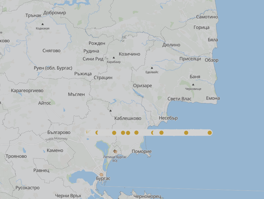
Fleet Tracking - real time

๐Ÿš— Fleet Tracking

Vehicle positioning with MVT tiles

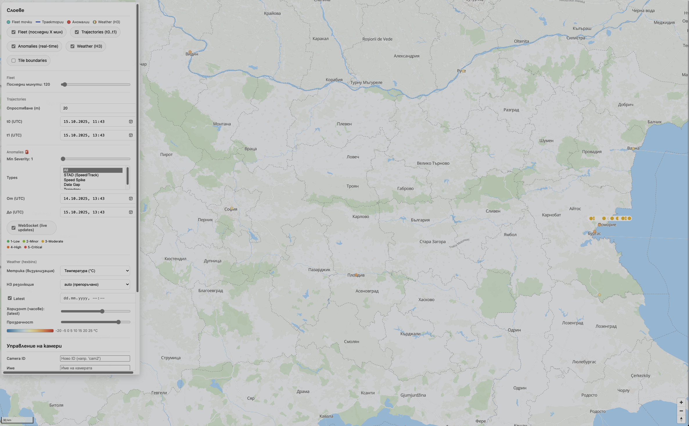
Interactive map

๐Ÿ—บ๏ธ Interactive Map

MapLibre GL with Bulgaria coverage

Control panel

โš™๏ธ Advanced Controls

Filters by time, type, severity and location

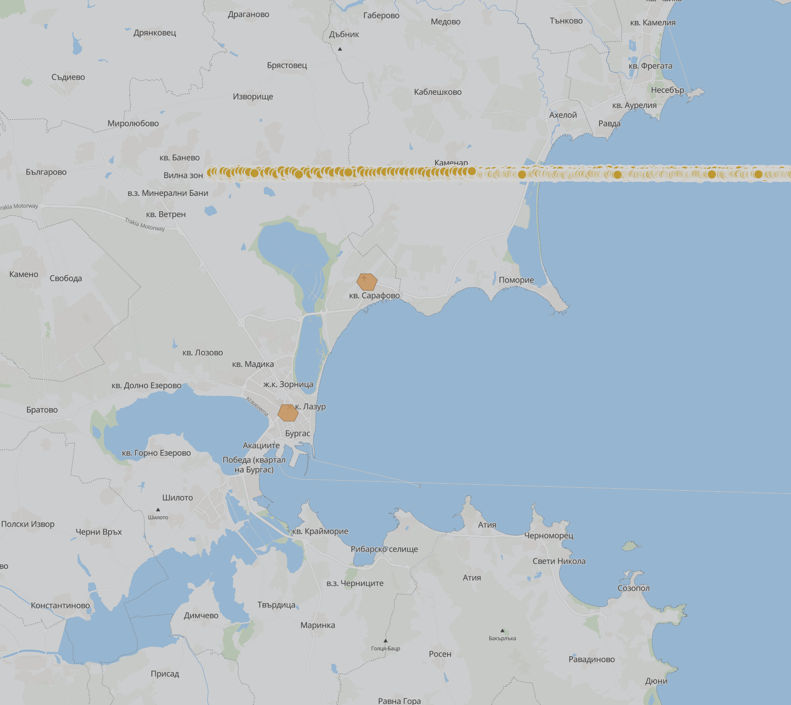
Weather analytics on H3

๐ŸŒฆ๏ธ Weather + Anomalies

H3 hexagonal binning with real-time data

๐Ÿ—๏ธ Microservice Ecosystem

Specialized services working in sync

๐ŸŒ Frontend & Gateway

๐ŸŽจ
Frontend

MapLibre GL + React interface

๐Ÿšช
API Gateway

Routing, auth, rate limiting

๐Ÿ”
Auth Service

JWT authentication

๐Ÿ“ก Data Ingestion

๐Ÿ“ฅ
Public API

External data ingestion

๐Ÿ”Œ
IoT Service

IoT device processing

๐Ÿ“น
Cam Hook

Camera feed integration

๐Ÿค– AI & Analytics

๐Ÿ’ฌ
NLQ Service

Natural Language โ†’ STSQL

๐Ÿ‘๏ธ
Vision Service

AI video/images

๐Ÿ“Š
Trajectory Embedding

Vectorization

๐Ÿ”ฎ
Trajectory Prediction

Forecasts

โš ๏ธ Anomaly Detection

๐Ÿ”
Anomaly Service

Pattern-based

๐Ÿงฌ
Anomaly Fusion

Correlation

โšก
Threat Forecaster

Predictive analysis

๐Ÿ“ก Edge Processing

๐Ÿ“ก
Radar Edge

Realtime radar

๐Ÿ”Š
Acoustic Edge

Audio analytics

๐Ÿ”„ Data Fusion

๐ŸŽฏ
Fusion Coordinator

Orchestration

๐Ÿ”—
Fusion Service

Merging

๐ŸŒค๏ธ Environmental

๐ŸŒก๏ธ
Weather Service

H3-indexed

โ˜๏ธ
Weather Fetcher

Integrations

โš™๏ธ Execution & Legacy

๐Ÿ”ง
WASM Exec

WebAssembly

๐ŸŽฐ
WASM Predict

ML inference

๐Ÿ—„๏ธ
Monolith API

Legacy bridge

๐Ÿ”ฎ Predictive Threat Forecasting

AI-powered risk assessment combining LSTM trajectory predictions, weather hazards, and anomaly patterns

๐Ÿง 

LSTM Predictions

86.9%

Trajectory risk score
20 trajectories analyzed

๐ŸŒค๏ธ

Weather Hazards

22.5%

Wind & storm risk
Real-time conditions

โฌก

H3 Resolution

R9

~0.1 kmยฒ cells
174m edge length

โฑ๏ธ

Forecast Window

30min

Prediction horizon
Configurable per request

Threat Level Classification

LOW

Score: 0.0 - 0.3

MEDIUM

Score: 0.3 - 0.7

HIGH

Score: 0.7 - 1.0

Multi-Source Fusion Algorithm

40% Weight
Anomaly Detection
Pattern-based risk scoring
35% Weight
Weather Hazards
Wind, storms, conditions
25% Weight
LSTM Trajectories
Prediction deviation analysis

API Endpoint: POST /api/threats/forecast

// Request
{
  "lat": 42.5048,
  "lon": 27.4626,
  "horizon_minutes": 30
}

// Response
{
  "threat_level": "medium",
  "threat_score": 0.313,
  "trajectory_score": 0.897,
  "weather_score": 0.255,
  "confidence": 1.0
}
Launch Threat Forecasting Interface โ†’

Modern Technology Stack

The best for maximum performance

Database

๐Ÿ—„๏ธPostgreSQL 16
๐ŸŒPostGIS 3.5
โฑ๏ธTimescaleDB
๐Ÿ”ทH3 Hex Index
โ„๏ธSnowflake ID

Visualization

๐Ÿ—บ๏ธMapLibre GL
๐Ÿ“ฆMVT Tiles
โšกPMTiles
๐Ÿ“ŠWebSocket

Backend & AI

โšกFastAPI
๐ŸPython 3.11+
๐Ÿ”„AsyncIO
๐Ÿค–Ollama LLM
๐Ÿง TensorFlow/PyTorch

Infrastructure

๐ŸณDocker Compose
๐ŸŒNginx
๐Ÿ”’SSL/TLS + JWT
๐Ÿ“ˆPrometheus + Grafana

Performance Breakthrough

Before (GeoJSON)
45-90 seconds
~2.3GB transfer Browser freeze
Now (MVT)
~0.4 seconds
100-800 bytes/tile Smooth render
~225ร— Faster Production-grade performance for millions of points

Atlas4D Use Cases

From safety to smart cities and industry

๐Ÿ›ก๏ธ

Safety

Drone incursions, anomalous trajectories, predictive alerts.

๐Ÿ™๏ธ

Smart Cities

Airspace, traffic, coordinated incident response.

๐Ÿ“ก

Telecom

Load forecasts, coverage optimization.

๐Ÿญ

Industry

Tracking, predictive maintenance, logistics.

๐Ÿš

Drone Operations

Routes, collision avoidance, optimal trajectories.

๐Ÿ”Œ

IoT Analytics

Massive streams, anomalies, smart notifications.

๐ŸŒ

Infrastructure

Temporal monitoring and change analysis.

๐ŸŒก๏ธ

Meteorology

H3 grid, Open-Meteo integrations and correlations.

Ready to get started?

Open the platform and experience real-time geospatial intelligence